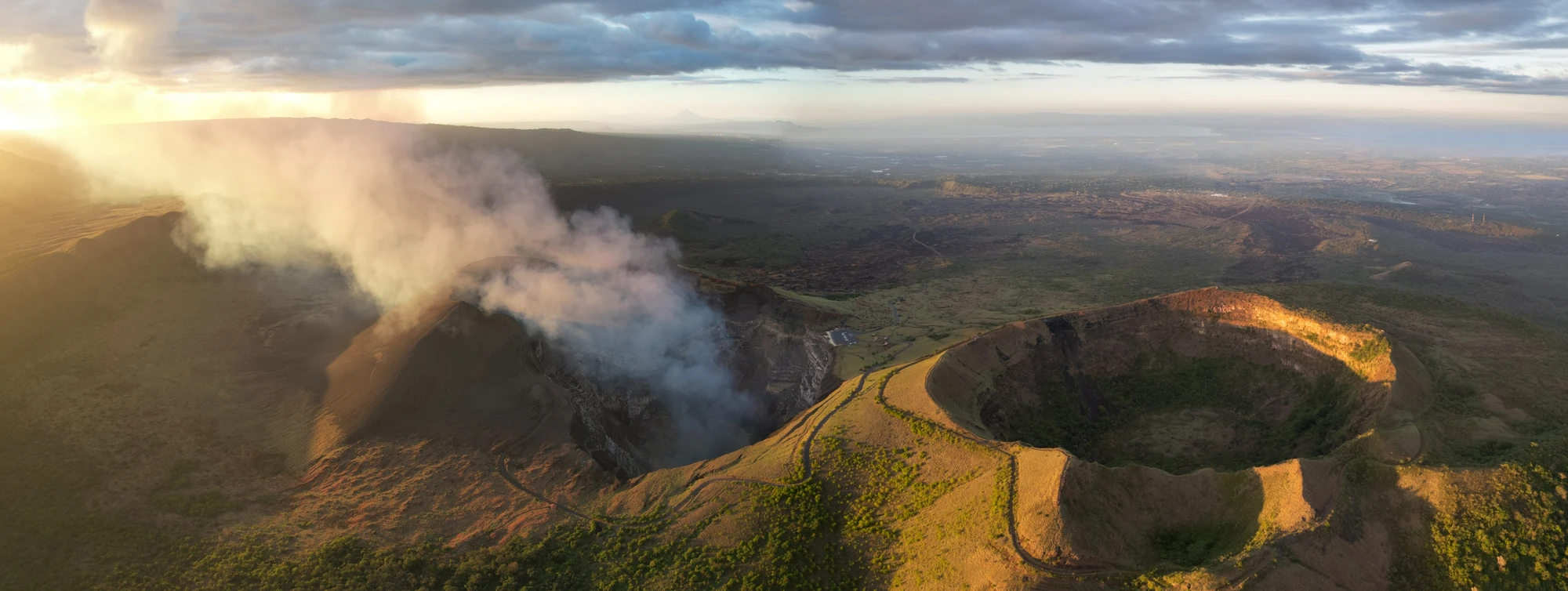
You reach the rim just after the sun clears the lake. The air is cooler—thick with the scent of damp earth and coffee leaves—and mist fingers through the trees like a deliberate hand. From the trail a few dozen meters below the parking area, the world drops away: Lake Nicaragua spreads like pewter glass, the colonial rooftops of Granada cluster on its shore, and in the distance the twin silhouettes of other volcanoes punctuate the horizon. Up here, on Mombacho Volcano’s shoulders, the cloud forest makes a private, patient kind of wilderness out of the tropics.
Mombacho Volcano, rising to about 1,344 meters, is less a symmetrical cone than a complex, living geologic story. It’s an extinct stratovolcano with four distinct craters—each a small universe of moss, bromeliads, and tree ferns nourished by constant moisture. The last recorded activity is traced to the 16th century (around 1570), but the real history you feel comes from the soil and people: coffee plantations on the lower slopes, ceramics workshops in nearby San Juan de Oriente, and a conservation effort that keeps the volcano one of Nicaragua’s protected jewels.
Geologically, Mombacho is younger than some of the neighboring peaks and older than others; its layering of ash and lava shows the episodic temper of Central America’s volcanic arc. But what makes it special to hikers is the cloud forest—a rare, high-humidity ecosystem where Orinoco-like fogs create perpetual green. That moisture gives rise to species that have adapted to living in mist: orchids that lean into the fog, howler monkeys that call across crater rims, and dozens of bird species that use the canopy like a highway. It’s intimate nature—trees that feel like columns, roots that braid over eroded rock, and narrow trails that force you into a slower pace.
Local culture threads through the visit. Coffee farms on the lower flanks supply beans to Granada’s cafés; the craft village of San Juan de Oriente, often included as part of full-day tours, showcases pre-Columbian pottery techniques that have survived here for generations. Tourism on Mombacho has been managed with an eye to community benefit: guided hikes are common and recommended, bringing work to local guides and interpreters while limiting impact on sensitive trails.
For the practical traveler, Mombacho is as flexible as it is scenic. A typical visit begins with a steep 4x4 ascent through coffee and citrus farms—actually a highlight for photographers and anyone who wants a snapshot of rural life. At the top, visitor facilities include a small tourist center with maps, a cafeteria, and restrooms; from there a network of trails leads along crater rims and into cloud forest. The crater trail itself is usually a 2–4 hour loop for most visitors when combined with time for observation and photography. Expect narrow, rooty track, occasional slick mud, and wind on exposed sections.
If you want to match adrenaline with ecology, several operators combine a crater hike with canopy ziplining—15 to 17 platforms and a dozen or so cables that thread you through the treetops above the very forest you’ve just walked. The contrast is enjoyable: boots and breath for the hike, harness and wind for the zipline. Another popular pairing is the full-day combo from Granada: a morning hike on Mombacho, a swim at Laguna de Apoyo (a crater lake), and a late-afternoon kayak through the Isletas of Granada. It’s a one-day primer to what Nicaragua’s volcanic landscapes offer.
Timing matters. On clear days the views across Lake Nicaragua and toward Masaya Volcano can be startlingly far-reaching; on misty days you’re rewarded with close-up moods of the cloud forest. Bring layers and expect wind at the summit—temperatures drop noticeably from the lake level—and wear footwear with good tread. Guides are not just for safety; they read the forest for you, pointing out howler monkeys, woodpeckers, and the subtle cues of a healthy cloud ecosystem.
For planners: Granada is the nearest city and the common base. From there it’s a 30–60 minute drive depending on your vehicle and the route. Many tours offer round-trip transport, which simplifies logistics and supports local operators. If you’re heading to Mombacho from beach towns like San Juan del Sur, expect a longer transfer (several hours), but many operators run daily shuttle-and-tour packages from those hubs.
Why hike Mombacho? It’s an accessible taste of high-elevation tropical forest without committing to multi-day trekking. It’s education wrapped in atmosphere: volcanic geology, traditional agriculture, and a compact biodiversity that’s readable in a single walk. And if you want something more than a walk, the canopy course and Isletas boat trips give you different ways to connect to the landscape—above, around, and below the clouds.
Practical edge: respect the trails, go with a guide if you’re short on experience or short on time, and schedule morning hikes for better light and calmer air. Bring a waterproof layer even in the dry season—the cloud forest makes its own weather. If you’re combining activities, leave buffer time between the hike and zipline; nothing deflates the enjoyment like hurrying through a canopy run because of timing.
Mombacho isn’t the most technical volcano on the map, but it’s one of the most rewarding: compact, diverse, and human-scaled. You leave the summit with more than a photograph—you come away with a sense of how tectonics, climate, and community have shaped a corner of Nicaragua into something both wild and accessible. The trees will still be there when you return your rental 4x4, but you’ll carry with you a few small, weathered mysteries: the echo of a monkey’s call, the way light slices through fog, and the clean, abrupt geometry of a crater rim.